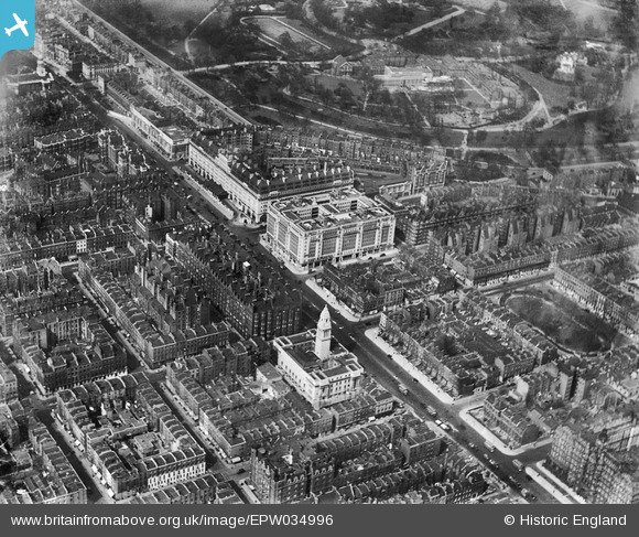
EPW034996 ENGLAND (1931). Westminster Council House, Berkeley Court, Marylebone Road and environs, Marylebone, 1931
© Copyright OpenStreetMap contributors and licensed by the OpenStreetMap Foundation. 2024. Cartography is licensed as CC BY-SA.
Nearby Images (22)
EPW034996

EPW034996
EPW034991

EPW034991
EPW034995

EPW034995
EPW034953

EPW034957

EPW034958

EPW034954

EPW034956

EPW034994

EPW034994
EPW034990

EPW034990
EPW034993

EPW034993
EPW034992

EPW034992
EPW034955

EPW044586

EPW008740

Details
| Title | [EPW034996] Westminster Council House, Berkeley Court, Marylebone Road and environs, Marylebone, 1931 |
| Reference | EPW034996 |
| Date | 14-April-1931 |
| Link | |
| Place name | MARYLEBONE |
| Parish | |
| District | |
| Country | ENGLAND |
| Easting / Northing | 527850, 181973 |
| Longitude / Latitude | -0.15699534156102, 51.521703576503 |
| National Grid Reference | TQ279820 |