
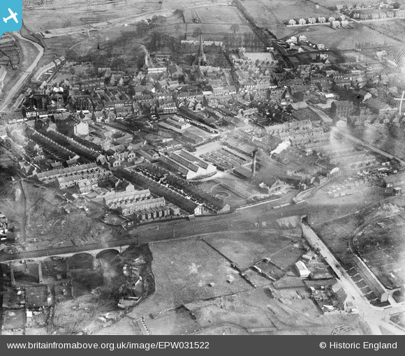
EPW031522 ENGLAND (1930). Horner Confectionery Works and the town centre, Chester-le-Street, 1930
© Copyright OpenStreetMap contributors and licensed by the OpenStreetMap Foundation. 2024. Cartography is licensed as CC BY-SA.
Nearby Images (15)
EPW031522

EPW031528

EPW031529

EPW031523

EPW031525

EPW014379

EPW014381

EPW032775

EPW031527

EPW031524

EPW031526

EPW032776

EPW016429

EPW031530

EPW014385

Details
| Title | [EPW031522] Horner Confectionery Works and the town centre, Chester-le-Street, 1930 |
| Reference | EPW031522 |
| Date | February-1930 |
| Link | |
| Place name | CHESTER-LE-STREET |
| Parish | |
| District | |
| Country | ENGLAND |
| Easting / Northing | 427248, 551405 |
| Longitude / Latitude | -1.575510585681, 54.856605854822 |
| National Grid Reference | NZ272514 |
Pins
 history group |
Monday 29th of April 2013 08:59:19 PM | |
history group |
Monday 29th of April 2013 08:58:28 PM | |
history group |
Monday 29th of April 2013 08:15:28 PM | |
Pelton Fell History Group |
Friday 19th of October 2012 11:38:15 AM | |
Pelton Fell History Group |
Friday 19th of October 2012 11:35:29 AM |
User Comment Contributions
 The group studied the history of Chester-le-Street using this and the other pictures of Chester-le-Street. This picture shows the start of the new council housing estates built to the west of the railway line. |
history group |
Friday 17th of January 2014 10:44:10 PM |
Chester-le-Street in Roman Times There was a Roman fort at Chester-le-Street from around the second century AD until about 410 AD. The earliest fort was turf and timber,and was found under the later fort in a recent excavation. An inscription stone dated 216 AD is dispayed in a museum next to the parish church. The Roman Fort was to the east of Front Street. The parish church was later built in the middle of the fort. Middle Chare leads from the old Roman road (now Front Street) to the site of the fort and the parish church. |
history group |
Monday 29th of April 2013 08:57:27 PM |