
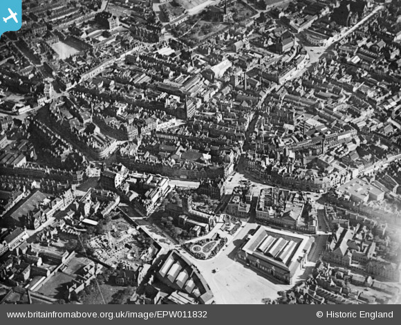
EPW011832 ENGLAND (1924). The city centre, Wolverhampton, 1924. This image has been produced from a copy-negative.
© Copyright OpenStreetMap contributors and licensed by the OpenStreetMap Foundation. 2024. Cartography is licensed as CC BY-SA.
Nearby Images (16)
EPW011832

EAW017630

EPW057476

EPW011774

EPW011835

EPW053724

EPW022595

EPW053728

EPW053729

EPW011780

EPR000569

EPW053730

EPW022897

EPW057474

EPR000556

EPW057479

Details
| Title | [EPW011832] The city centre, Wolverhampton, 1924. This image has been produced from a copy-negative. |
| Reference | EPW011832 |
| Date | September-1924 |
| Link | |
| Place name | WOLVERHAMPTON |
| Parish | |
| District | |
| Country | ENGLAND |
| Easting / Northing | 391501, 298697 |
| Longitude / Latitude | -2.1254566165539, 52.585655778973 |
| National Grid Reference | SO915987 |


