
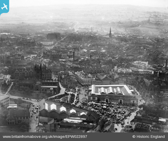
EPW022897 ENGLAND (1928). St Peter's Collegiate Church and the Market Place, Wolverhampton, from the north, 1928
© Copyright OpenStreetMap contributors and licensed by the OpenStreetMap Foundation. 2024. Cartography is licensed as CC BY-SA.
Nearby Images (14)
EPW022897

EPW053729

EPR000556

EPW053728

EPW022595

EPW061263

EPW053724

EPW057478

EPW011835

EPW011832

EPW053730

EPW011774

EPW057476

EAW017630

Details
| Title | [EPW022897] St Peter's Collegiate Church and the Market Place, Wolverhampton, from the north, 1928 |
| Reference | EPW022897 |
| Date | August-1928 |
| Link | |
| Place name | WOLVERHAMPTON |
| Parish | |
| District | |
| Country | ENGLAND |
| Easting / Northing | 391334, 298860 |
| Longitude / Latitude | -2.1279260204256, 52.587118646236 |
| National Grid Reference | SO913989 |
Pins
 RFD W'ton |
Tuesday 21st of August 2018 11:15:05 PM | |
RFD W'ton |
Tuesday 21st of August 2018 11:12:23 PM | |
RFD W'ton |
Tuesday 21st of August 2018 11:10:33 PM | |
RFD W'ton |
Tuesday 21st of August 2018 11:09:07 PM | |
RFD W'ton |
Tuesday 21st of August 2018 11:03:03 PM | |
RFD W'ton |
Tuesday 21st of August 2018 11:01:28 PM | |
RFD W'ton |
Tuesday 21st of August 2018 10:56:42 PM | |
garygareth |
Thursday 21st of March 2013 02:41:06 PM | |
garygareth |
Thursday 21st of March 2013 02:40:15 PM | |
garygareth |
Thursday 21st of March 2013 02:39:32 PM | |
garygareth |
Thursday 21st of March 2013 02:38:07 PM |


