
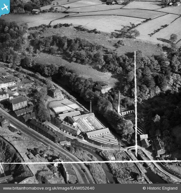
EAW052640 ENGLAND (1953). Nanholme Mill, Todmorden, 1953. This image was marked by Aerofilms Ltd for photo editing.
© Copyright OpenStreetMap contributors and licensed by the OpenStreetMap Foundation. 2024. Cartography is licensed as CC BY-SA.
Nearby Images (9)
EAW052640

EAW052641

EAW052642

EAW052643

EAW052645

EAW052644

EAW052639

EAW052637

EAW052638

Details
| Title | [EAW052640] Nanholme Mill, Todmorden, 1953. This image was marked by Aerofilms Ltd for photo editing. |
| Reference | EAW052640 |
| Date | 4-October-1953 |
| Link | |
| Place name | TODMORDEN |
| Parish | TODMORDEN |
| District | |
| Country | ENGLAND |
| Easting / Northing | 396081, 424743 |
| Longitude / Latitude | -2.0593931431363, 53.718859490272 |
| National Grid Reference | SD961247 |
Pins
 wadey |
Saturday 8th of November 2014 01:55:44 PM | |
wadey |
Saturday 8th of November 2014 01:55:15 PM | |
wadey |
Saturday 8th of November 2014 01:54:58 PM | |
wadey |
Saturday 8th of November 2014 01:54:35 PM |


