
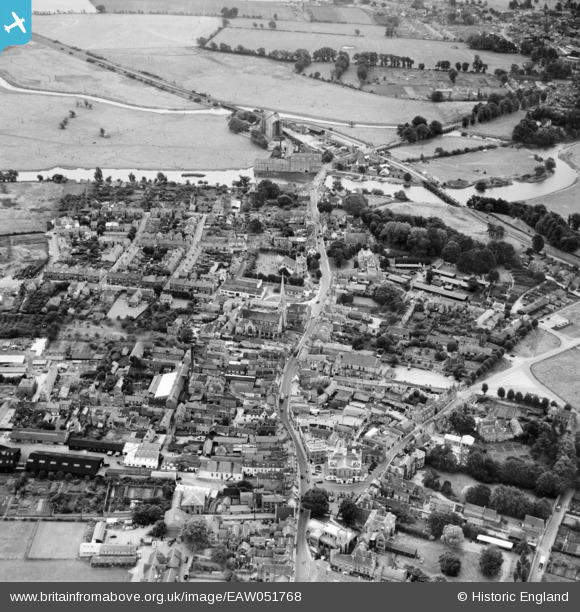
EAW051768 ENGLAND (1953). The High Street and town, Huntingdon, 1953
© Copyright OpenStreetMap contributors and licensed by the OpenStreetMap Foundation. 2024. Cartography is licensed as CC BY-SA.
Nearby Images (11)
EAW051768

EAW051769

EPW009849

EPW009841

EPW014427

EAW051770

EPW014430

EPW014431

EAW051767

EPW041330

EPW041329

Details
| Title | [EAW051768] The High Street and town, Huntingdon, 1953 |
| Reference | EAW051768 |
| Date | 14-August-1953 |
| Link | |
| Place name | HUNTINGDON |
| Parish | HUNTINGDON |
| District | |
| Country | ENGLAND |
| Easting / Northing | 524054, 271675 |
| Longitude / Latitude | -0.17934708046524, 52.328737272873 |
| National Grid Reference | TL241717 |
Pins
 Matt Aldred edob.mattaldred.com |
Sunday 8th of November 2020 08:56:29 PM | |
Matt Aldred edob.mattaldred.com |
Sunday 8th of November 2020 08:42:57 PM | |
 Ray |
Thursday 30th of January 2020 09:18:00 PM | |
alastair wallace |
Monday 19th of October 2015 07:21:26 PM |


