
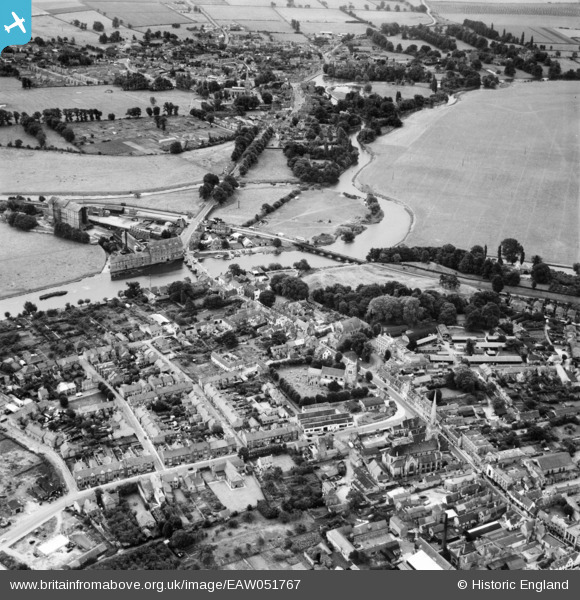
EAW051767 ENGLAND (1953). The High Street, St Mary's Church and the River Great Ouse, Huntingdon, 1953
© Copyright OpenStreetMap contributors and licensed by the OpenStreetMap Foundation. 2024. Cartography is licensed as CC BY-SA.
Nearby Images (17)
EAW051767

EPW041329

EPW041330

EPW014427

EAW031845

EAW031839

EAW031838

EAW031843

EAW031841

EAW031840

EPW014429

EAW031837

EAW031842

EAW031844

EAW051769

EAW051768

EPW009849

Details
| Title | [EAW051767] The High Street, St Mary's Church and the River Great Ouse, Huntingdon, 1953 |
| Reference | EAW051767 |
| Date | 14-August-1953 |
| Link | |
| Place name | HUNTINGDON |
| Parish | HUNTINGDON |
| District | |
| Country | ENGLAND |
| Easting / Northing | 524191, 271472 |
| Longitude / Latitude | -0.17741252913899, 52.326881981433 |
| National Grid Reference | TL242715 |
Pins
 Matt Aldred edob.mattaldred.com |
Friday 3rd of May 2019 05:21:27 PM | |
 Galileo |
Saturday 23rd of March 2019 11:35:16 AM |


