
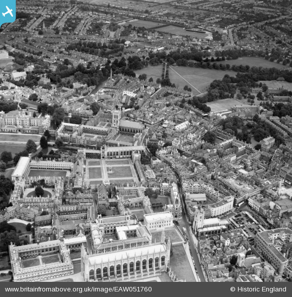
EAW051760 ENGLAND (1953). St John's College, Trinity College, King's College Chapel and environs, Cambridge, 1953
© Copyright OpenStreetMap contributors and licensed by the OpenStreetMap Foundation. 2024. Cartography is licensed as CC BY-SA.
Nearby Images (21)
EAW051760

EPW000050

EAW011269

EPW025479

EAW051759

EAW002915

EAW051761

EPW009783

EPW009786

EAW014115

EPW009787

EPW045032

EAW002914
, Cambridge, 1946")
EPW009777

EPW009776

EAW002916

EAW002923

EPW025467
, Cambridge, 1928. This image has been produced from a copy-negative.")
EAW004873

EPW000045

EPW009779

Details
| Title | [EAW051760] St John's College, Trinity College, King's College Chapel and environs, Cambridge, 1953 |
| Reference | EAW051760 |
| Date | 14-August-1953 |
| Link | |
| Place name | CAMBRIDGE |
| Parish | |
| District | |
| Country | ENGLAND |
| Easting / Northing | 544827, 258744 |
| Longitude / Latitude | 0.1197616935126, 52.207460522753 |
| National Grid Reference | TL448587 |
Pins
 Matt Aldred edob.mattaldred.com |
Sunday 12th of April 2020 11:12:51 AM |


