
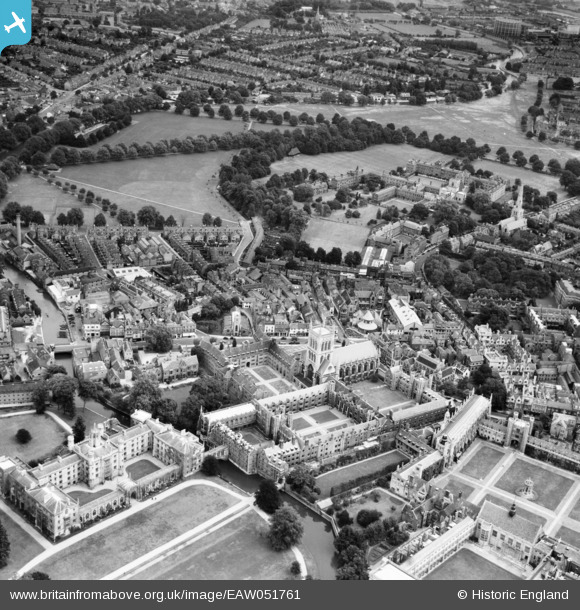
EAW051761 ENGLAND (1953). St John's College and environs, Cambridge, 1953
© Copyright OpenStreetMap contributors and licensed by the OpenStreetMap Foundation. 2024. Cartography is licensed as CC BY-SA.
Nearby Images (7)
EAW051761

EAW051760

EPW000050

EAW011260

EPW025479

EAW011269

EAW002915

Details
| Title | [EAW051761] St John's College and environs, Cambridge, 1953 |
| Reference | EAW051761 |
| Date | 14-August-1953 |
| Link | |
| Place name | CAMBRIDGE |
| Parish | |
| District | |
| Country | ENGLAND |
| Easting / Northing | 544902, 258886 |
| Longitude / Latitude | 0.12091939743443, 52.208716713045 |
| National Grid Reference | TL449589 |
Pins
Be the first to add a comment to this image!


