
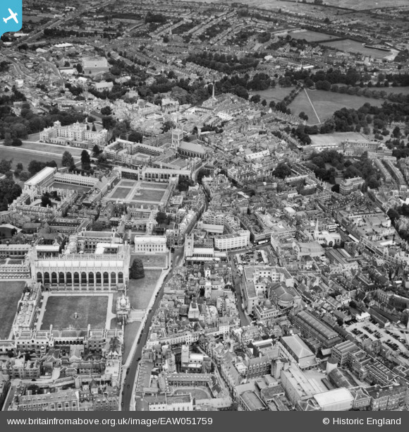
EAW051759 ENGLAND (1953). King's College, Trinity College and the city centre, Cambridge, 1953
© Copyright OpenStreetMap contributors and licensed by the OpenStreetMap Foundation. 2024. Cartography is licensed as CC BY-SA.
Nearby Images (39)
EAW051759

EAW051760

EPW045033

EPW009783

EPW059042

EAW002923

EAW002916

EPW059036

EAW002922

EAW011269

EAW002915

EPW025479

EAW002925

EPW009777

EPW000050

EPW009776

EAW002924

EPW000045

EPW059041

EAW004873

EPW009779

EPW009772

EPW045032

EPW059037

EPW009771

EAW014115

EPW025476

EPW000046

EPW000053

EAW011270

EPW059038

EAW002917

EPW009782

EPW025478

EPW025481

EPW009786

EPW009787

EPW045031

EAW002914
, Cambridge, 1946")
Details
| Title | [EAW051759] King's College, Trinity College and the city centre, Cambridge, 1953 |
| Reference | EAW051759 |
| Date | 14-August-1953 |
| Link | |
| Place name | CAMBRIDGE |
| Parish | |
| District | |
| Country | ENGLAND |
| Easting / Northing | 544838, 258599 |
| Longitude / Latitude | 0.11986054324279, 52.20615476827 |
| National Grid Reference | TL448586 |
Pins
Be the first to add a comment to this image!


