
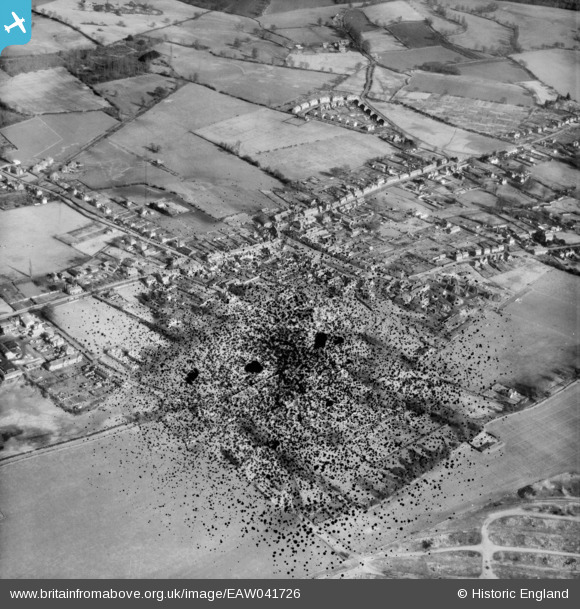
EAW041726 ENGLAND (1952). The town centre, Thatcham, 1952. This image has been produced from a damaged negative.
© Copyright OpenStreetMap contributors and licensed by the OpenStreetMap Foundation. 2024. Cartography is licensed as CC BY-SA.
Nearby Images (12)
EAW041726

EAW041725

EPW036223

EPW023277

EPW036222

EAW041723

EPW036226

EAW041724

EPW036220

EPW023280

EPW023278

EPW023279

Details
| Title | [EAW041726] The town centre, Thatcham, 1952. This image has been produced from a damaged negative. |
| Reference | EAW041726 |
| Date | 20-February-1952 |
| Link | |
| Place name | THATCHAM |
| Parish | THATCHAM |
| District | |
| Country | ENGLAND |
| Easting / Northing | 451648, 167292 |
| Longitude / Latitude | -1.2574476382056, 51.401809236008 |
| National Grid Reference | SU516673 |
Pins

User Comment Contributions
 St Mary's Church 02/11/2014 |
 Class31 |
Wednesday 23rd of April 2014 02:55:34 PM |