
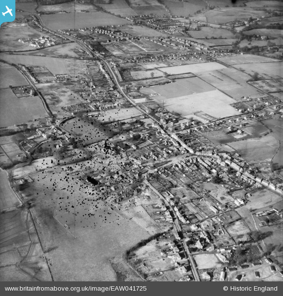
EAW041725 ENGLAND (1952). The town, Thatcham, 1952. This image has been produced from a damaged negative.
© Copyright OpenStreetMap contributors and licensed by the OpenStreetMap Foundation. 2024. Cartography is licensed as CC BY-SA.
Nearby Images (12)
EAW041725

EAW041726

EAW041724

EAW041723

EPW036223

EPW036220

EPW023280

EPW023277

EPW036222

EPW036226

EPW023278

EPW023279

Details
| Title | [EAW041725] The town, Thatcham, 1952. This image has been produced from a damaged negative. |
| Reference | EAW041725 |
| Date | 20-February-1952 |
| Link | |
| Place name | THATCHAM |
| Parish | THATCHAM |
| District | |
| Country | ENGLAND |
| Easting / Northing | 451637, 167333 |
| Longitude / Latitude | -1.2575998037467, 51.402178905785 |
| National Grid Reference | SU516673 |
Pins
 Mark home |
Monday 28th of August 2023 03:05:42 PM | |
Terry |
Thursday 22nd of December 2016 09:55:34 PM | |
Julierosalie |
Sunday 11th of May 2014 08:18:20 PM | |
Julierosalie |
Sunday 11th of May 2014 08:17:22 PM | |
Julierosalie |
Sunday 11th of May 2014 08:13:58 PM | |
Julierosalie |
Sunday 11th of May 2014 08:00:45 PM | |
Julierosalie |
Sunday 11th of May 2014 07:57:26 PM | |
Julierosalie |
Sunday 11th of May 2014 07:54:56 PM | |
Henwick Lane |
Nickbits |
Tuesday 9th of September 2014 07:50:23 AM |
Julierosalie |
Sunday 11th of May 2014 07:54:06 PM | |
Julierosalie |
Sunday 11th of May 2014 06:55:51 PM | |
Nickbits |
Tuesday 22nd of April 2014 09:38:15 PM | |
Nickbits |
Tuesday 22nd of April 2014 09:37:57 PM |
User Comment Contributions
 St Mary's Church 02/11/2014 |
 Class31 |
Wednesday 23rd of April 2014 02:54:43 PM |