
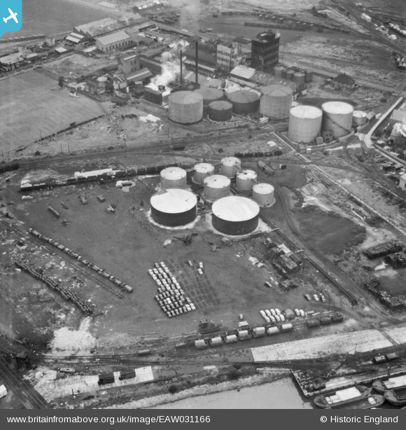
EAW031166 ENGLAND (1950). The fuel storage depot beside Dagenham Dock, Dagenham, 1950
© Copyright OpenStreetMap contributors and licensed by the OpenStreetMap Foundation. 2024. Cartography is licensed as CC BY-SA.
Nearby Images (48)
EAW031166

EAW031165

EAW046771

EAW031159

EAW031163

EPW021395

EAW046775

EPW046614

EAW046778

EPW046546

EPW009947

EPW046551

EPW021391

EPW021398

EPW021389

EPW046515

EAW046777

EAW046774

EPW046552

EAW046780

EPW046548

EPW046553

EPW059965

EPW009951

EPW046550

EPW021394

EPW009946

EPW046547

EPW021396

EPW046549

EPW059964

EPW021397

EAW031154

EPW059961

EPW046615

EPW046613

EPW059962

EPW059963

EPW059966

EAW046772

EPW059960

EPW059967

EAW046625

EAW031160

EAW046773

EAW046776

EPW021390

EAW046624

Details
| Title | [EAW031166] The fuel storage depot beside Dagenham Dock, Dagenham, 1950 |
| Reference | EAW031166 |
| Date | 25-July-1950 |
| Link | |
| Place name | DAGENHAM |
| Parish | |
| District | |
| Country | ENGLAND |
| Easting / Northing | 548688, 182063 |
| Longitude / Latitude | 0.14321980529955, 51.517410644138 |
| National Grid Reference | TQ487821 |
Pins
Be the first to add a comment to this image!