
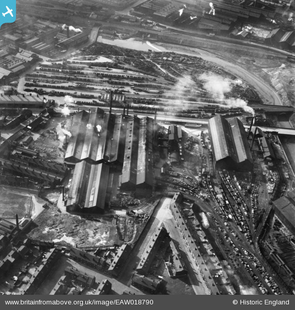
EAW018790 ENGLAND (1948). The English Steel Corporation Ltd Stevenson Road Steel Works and environs, Attercliffe, 1948
© Copyright OpenStreetMap contributors and licensed by the OpenStreetMap Foundation. 2024. Cartography is licensed as CC BY-SA.
Nearby Images (18)
EAW018790

EAW018788

EAW018787

EAW020082

EAW020079

EAW018789

EAW020078

EAW018792

EAW020087

EAW020084

EAW020086

EAW018791

EAW020083

EAW020081

EAW020080

EAW020085

EAW040022

EAW040021

Details
| Title | [EAW018790] The English Steel Corporation Ltd Stevenson Road Steel Works and environs, Attercliffe, 1948 |
| Reference | EAW018790 |
| Date | 21-September-1948 |
| Link | |
| Place name | ATTERCLIFFE |
| Parish | |
| District | |
| Country | ENGLAND |
| Easting / Northing | 437551, 388814 |
| Longitude / Latitude | -1.4352405437478, 53.394559379914 |
| National Grid Reference | SK376888 |
Pins
Be the first to add a comment to this image!


