
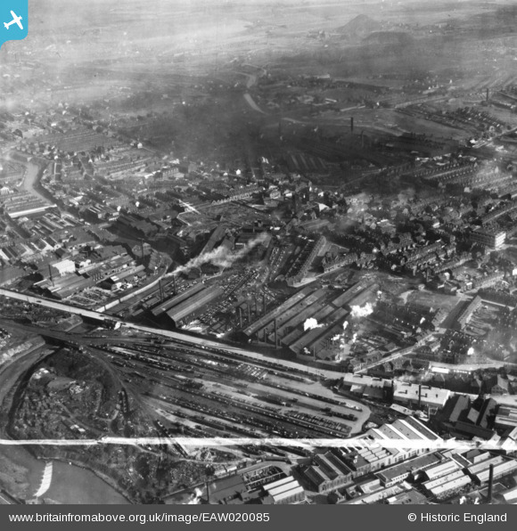
EAW020085 ENGLAND (1948). The English Steel Corporation Stevenson Road Works and environs, Attercliffe, 1948. This image has been produced from a print marked by Aerofilms Ltd for photo editing.
© Copyright OpenStreetMap contributors and licensed by the OpenStreetMap Foundation. 2024. Cartography is licensed as CC BY-SA.
Nearby Images (15)
EAW020085

EAW020080

EAW020081

EAW020083

EAW018791

EAW020084

EAW018789

EAW020087

EAW018792

EAW018788

EAW018787

EAW020082

EAW018790

EAW020086

EAW020079

Details
| Title | [EAW020085] The English Steel Corporation Stevenson Road Works and environs, Attercliffe, 1948. This image has been produced from a print marked by Aerofilms Ltd for photo editing. |
| Reference | EAW020085 |
| Date | 19-October-1948 |
| Link | |
| Place name | ATTERCLIFFE |
| Parish | |
| District | |
| Country | ENGLAND |
| Easting / Northing | 437753, 388903 |
| Longitude / Latitude | -1.4321920191928, 53.395345009597 |
| National Grid Reference | SK378889 |
Pins
 redmist |
Thursday 27th of January 2022 08:26:32 PM | |
 Matt Aldred edob.mattaldred.com |
Monday 30th of November 2020 08:23:56 PM | |
Cyberbia |
Sunday 6th of October 2019 10:41:26 AM |


