
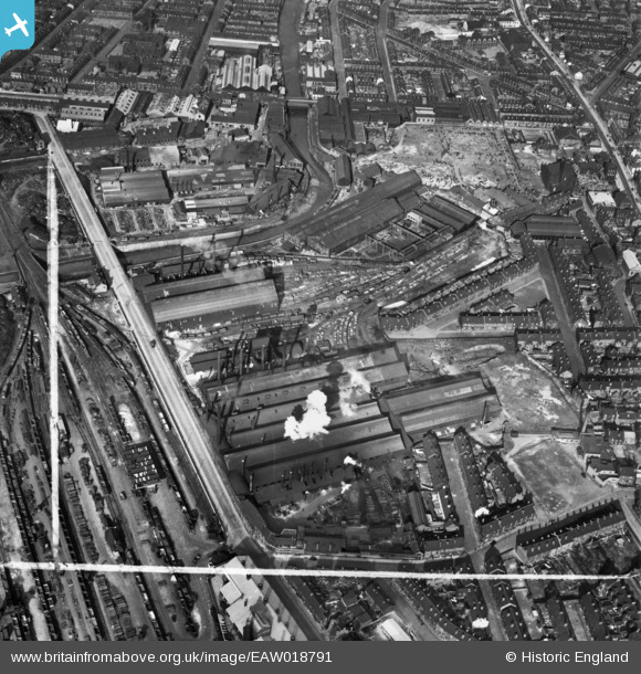
EAW018791 ENGLAND (1948). The English Steel Corporation Ltd Stevenson Road Steel Works and environs, Attercliffe, 1948. This image was marked by Aerofilms Ltd for photo editing.
© Copyright OpenStreetMap contributors and licensed by the OpenStreetMap Foundation. 2024. Cartography is licensed as CC BY-SA.
Nearby Images (16)
EAW018791

EAW018789

EAW020084

EAW020087

EAW018792

EAW018787

EAW018788

EAW020082

EAW020083

EAW018790

EAW020086

EAW020081

EAW020078

EAW020080

EAW020079

EAW020085

Details
| Title | [EAW018791] The English Steel Corporation Ltd Stevenson Road Steel Works and environs, Attercliffe, 1948. This image was marked by Aerofilms Ltd for photo editing. |
| Reference | EAW018791 |
| Date | 21-September-1948 |
| Link | |
| Place name | ATTERCLIFFE |
| Parish | |
| District | |
| Country | ENGLAND |
| Easting / Northing | 437616, 388866 |
| Longitude / Latitude | -1.4342568101175, 53.395022189822 |
| National Grid Reference | SK376889 |
Pins
 Cyberbia |
Sunday 6th of October 2019 10:43:42 AM | |
Cyberbia |
Sunday 6th of October 2019 10:43:08 AM | |
Cyberbia |
Sunday 6th of October 2019 10:42:43 AM | |
circloy |
Sunday 12th of October 2014 07:30:56 PM | |
circloy |
Sunday 12th of October 2014 07:29:27 PM |


