
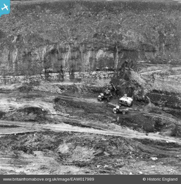
EAW017989 ENGLAND (1948). Opencast coal mining to the north of Kidsleypark Farm, Smalley, 1948. This image has been produced from a print.
© Copyright OpenStreetMap contributors and licensed by the OpenStreetMap Foundation. 2024. Cartography is licensed as CC BY-SA.
Nearby Images (13)
EAW017989

EAW017990

EAW017952

EAW017988

EAW017947

EAW017957

EAW017984

EAW017959

EAW017987

EAW011221

EAW011251

EAW011228

EAW011229

Details
| Title | [EAW017989] Opencast coal mining to the north of Kidsleypark Farm, Smalley, 1948. This image has been produced from a print. |
| Reference | EAW017989 |
| Date | 10-August-1948 |
| Link | |
| Place name | SMALLEY |
| Parish | SMALLEY |
| District | |
| Country | ENGLAND |
| Easting / Northing | 441379, 346134 |
| Longitude / Latitude | -1.3832048847105, 53.010606257737 |
| National Grid Reference | SK414461 |
Pins
 |
 Billy Turner |
Thursday 9th of March 2017 08:16:26 PM |


