
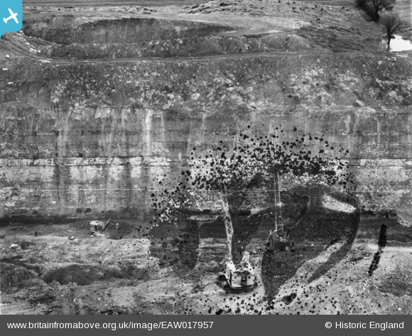
EAW017957 ENGLAND (1948). Opencast coal mining to the north of Carrington's Farm, Smalley, 1948. This image has been produced from a damaged negative.
© Copyright OpenStreetMap contributors and licensed by the OpenStreetMap Foundation. 2024. Cartography is licensed as CC BY-SA.
Nearby Images (14)
EAW017957

EAW017947

EAW017984

EAW017988

EAW017952

EAW017989

EAW017959

EAW017990

EAW017987

EAW011251

EAW011228

EAW011221

EAW012048

EAW011229

Details
| Title | [EAW017957] Opencast coal mining to the north of Carrington's Farm, Smalley, 1948. This image has been produced from a damaged negative. |
| Reference | EAW017957 |
| Date | 10-August-1948 |
| Link | |
| Place name | SMALLEY |
| Parish | SMALLEY |
| District | |
| Country | ENGLAND |
| Easting / Northing | 441397, 346088 |
| Longitude / Latitude | -1.3829424920145, 53.010191340729 |
| National Grid Reference | SK414461 |
Pins
Be the first to add a comment to this image!


