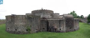
EAW014342 ENGLAND (1948). Deal Castle, Deal, 1948. This image has been produced from a print.
© Copyright OpenStreetMap contributors and licensed by the OpenStreetMap Foundation. 2024. Cartography is licensed as CC BY-SA.
Nearby Images (18)
Details
| Title | [EAW014342] Deal Castle, Deal, 1948. This image has been produced from a print. |
| Reference | EAW014342 |
| Date | 13-April-1948 |
| Link | |
| Place name | DEAL |
| Parish | DEAL |
| District | |
| Country | ENGLAND |
| Easting / Northing | 637739, 152246 |
| Longitude / Latitude | 1.4048928741283, 51.219308703393 |
| National Grid Reference | TR377522 |
Pins
 Alan McFaden |
Friday 24th of October 2014 09:33:54 AM |


![[EAW014342] Deal Castle, Deal, 1948. This image has been produced from a print.](http://britainfromabove.org.uk/sites/all/libraries/aerofilms-images/public/100x100/EAW/014/EAW014342.jpg)
![[EPW035434] Deal Artillery Castle, the Deal Promenade Pier and the town, Deal, 1931](http://britainfromabove.org.uk/sites/all/libraries/aerofilms-images/public/100x100/EPW/035/EPW035434.jpg)
![[EAW014345] Deal Castle, Deal, 1948](http://britainfromabove.org.uk/sites/all/libraries/aerofilms-images/public/100x100/EAW/014/EAW014345.jpg)
![[EAW014346] Deal Castle, Deal, 1948. This image has been produced from a print.](http://britainfromabove.org.uk/sites/all/libraries/aerofilms-images/public/100x100/EAW/014/EAW014346.jpg)
![[EPW000640] Deal Castle, Deal, 1920](http://britainfromabove.org.uk/sites/all/libraries/aerofilms-images/public/100x100/EPW/000/EPW000640.jpg)
![[EAW014343] Deal Castle, Deal, 1948. This image has been produced from a print.](http://britainfromabove.org.uk/sites/all/libraries/aerofilms-images/public/100x100/EAW/014/EAW014343.jpg)
![[EPW035438] Deal Artillery Castle, the town and seafront, Deal, 1931](http://britainfromabove.org.uk/sites/all/libraries/aerofilms-images/public/100x100/EPW/035/EPW035438.jpg)
![[EPW000333] Deal Castle, Deal, 1920. This image has been produced from a print.](http://britainfromabove.org.uk/sites/all/libraries/aerofilms-images/public/100x100/EPW/000/EPW000333.jpg)
![[EAW014344] Deal Castle, Deal, 1948](http://britainfromabove.org.uk/sites/all/libraries/aerofilms-images/public/100x100/EAW/014/EAW014344.jpg)
![[EPW019062] Deal Castle, Deal, 1927](http://britainfromabove.org.uk/sites/all/libraries/aerofilms-images/public/100x100/EPW/019/EPW019062.jpg)
![[EPW009182] Deal Castle, Deal, 1923](http://britainfromabove.org.uk/sites/all/libraries/aerofilms-images/public/100x100/EPW/009/EPW009182.jpg)
![[EPW035432] Deal Artillery Castle, Deal, 1931](http://britainfromabove.org.uk/sites/all/libraries/aerofilms-images/public/100x100/EPW/035/EPW035432.jpg)
![[EPW000647] Deal Castle, Deal, 1920](http://britainfromabove.org.uk/sites/all/libraries/aerofilms-images/public/100x100/EPW/000/EPW000647.jpg)
![[EPW019059] Gladstone Road, the town and the pier, Deal, 1927. This image has been produced from a print.](http://britainfromabove.org.uk/sites/all/libraries/aerofilms-images/public/100x100/EPW/019/EPW019059.jpg)
![[EPW042833] Deal Castle and the seafront, Deal, from the south, 1933](http://britainfromabove.org.uk/sites/all/libraries/aerofilms-images/public/100x100/EPW/042/EPW042833.jpg)
![[EPW039321] The town and pier, Deal, from the south-west, 1932. This image has been affected by flare.](http://britainfromabove.org.uk/sites/all/libraries/aerofilms-images/public/100x100/EPW/039/EPW039321.jpg)
![[EPW000648] Deal Castle, Deal, from the south-east, 1920](http://britainfromabove.org.uk/sites/all/libraries/aerofilms-images/public/100x100/EPW/000/EPW000648.jpg)
![[EPW039322] Beach Street and the pier, Deal, 1932](http://britainfromabove.org.uk/sites/all/libraries/aerofilms-images/public/100x100/EPW/039/EPW039322.jpg)
