
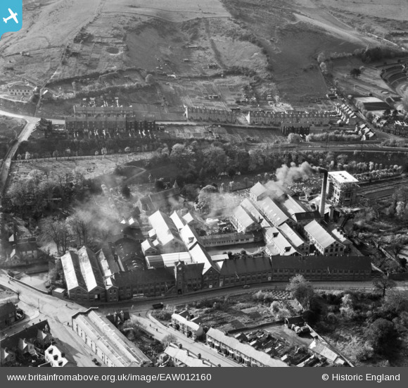
EAW012160 ENGLAND (1947). Buckland Paper Mill, Buckland, 1947
© Copyright OpenStreetMap contributors and licensed by the OpenStreetMap Foundation. 2025. Cartography is licensed as CC BY-SA.
Nearby Images (11)
EAW012160

EAW012163

EAW012164

EAW012161

EPW038165

EAW012158

EAW012162

EAW012165

EPW038164

EAW012159

EPW038166

Details
| Title | [EAW012160] Buckland Paper Mill, Buckland, 1947 |
| Reference | EAW012160 |
| Date | 10-November-1947 |
| Link | |
| Place name | BUCKLAND |
| Parish | DOVER |
| District | |
| Country | ENGLAND |
| Easting / Northing | 630456, 142766 |
| Longitude / Latitude | 1.2946953096935, 51.137182500831 |
| National Grid Reference | TR305428 |
Pins
 ATC |
Monday 6th of January 2014 01:16:18 PM |