
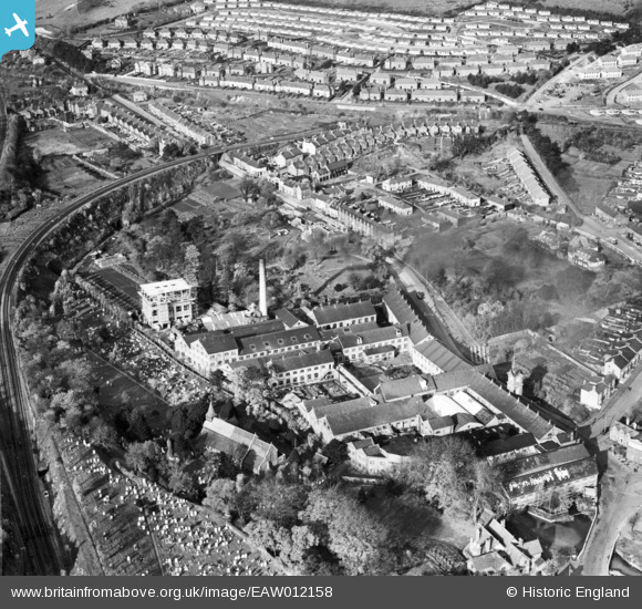
EAW012158 ENGLAND (1947). Buckland Paper Mill and St Andrew's Church, Buckland, 1947
© Copyright OpenStreetMap contributors and licensed by the OpenStreetMap Foundation. 2025. Cartography is licensed as CC BY-SA.
Nearby Images (11)
EAW012158

EAW012163

EPW038166

EAW012159

EAW012164

EPW038164

EAW012160

EAW012161

EPW038165

EAW012165

EAW012162

Details
| Title | [EAW012158] Buckland Paper Mill and St Andrew's Church, Buckland, 1947 |
| Reference | EAW012158 |
| Date | 10-November-1947 |
| Link | |
| Place name | BUCKLAND |
| Parish | DOVER |
| District | |
| Country | ENGLAND |
| Easting / Northing | 630466, 142880 |
| Longitude / Latitude | 1.2949109511584, 51.1382019892 |
| National Grid Reference | TR305429 |
Pins
 Stubzi34 |
Tuesday 9th of August 2016 04:03:09 PM |