
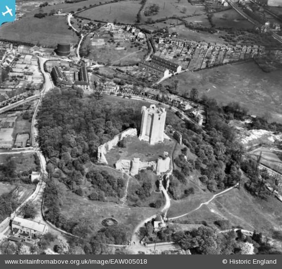
EAW005018 ENGLAND (1947). Conisbrough Castle, Conisbrough, 1947. This image has been produced from a print.
© Copyright OpenStreetMap contributors and licensed by the OpenStreetMap Foundation. 2024. Cartography is licensed as CC BY-SA.
Nearby Images (8)
EAW005018

EAW005017

EAW005020

EPW014866

EAW005016

EAW005019

EPW014865

EPW014867

Details
| Title | [EAW005018] Conisbrough Castle, Conisbrough, 1947. This image has been produced from a print. |
| Reference | EAW005018 |
| Date | 7-May-1947 |
| Link | |
| Place name | CONISBROUGH |
| Parish | |
| District | |
| Country | ENGLAND |
| Easting / Northing | 451466, 398912 |
| Longitude / Latitude | -1.2243285141321, 53.484154435185 |
| National Grid Reference | SK515989 |
Pins
Be the first to add a comment to this image!


