
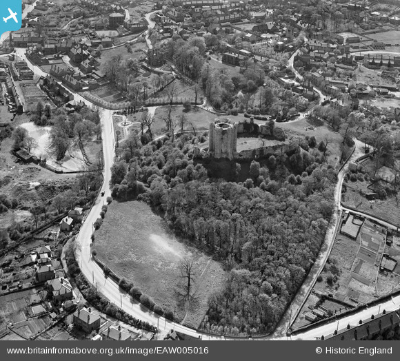
EAW005016 ENGLAND (1947). Conisbrough Castle, Conisbrough, 1947
© Copyright OpenStreetMap contributors and licensed by the OpenStreetMap Foundation. 2024. Cartography is licensed as CC BY-SA.
Nearby Images (7)
EAW005016

EAW005017

EAW005018

EAW005019

EAW005020

EPW014866

EPW014865

Details
| Title | [EAW005016] Conisbrough Castle, Conisbrough, 1947 |
| Reference | EAW005016 |
| Date | 7-May-1947 |
| Link | |
| Place name | CONISBROUGH |
| Parish | |
| District | |
| Country | ENGLAND |
| Easting / Northing | 451495, 398915 |
| Longitude / Latitude | -1.2238909914902, 53.484178563985 |
| National Grid Reference | SK515989 |
Pins
 totoro |
Monday 14th of October 2013 10:37:29 AM | |
totoro |
Monday 14th of October 2013 10:36:19 AM | |
totoro |
Monday 14th of October 2013 10:35:58 AM | |
totoro |
Monday 14th of October 2013 10:34:36 AM | |
totoro |
Monday 14th of October 2013 10:34:00 AM | |
totoro |
Monday 14th of October 2013 10:31:59 AM | |
totoro |
Monday 14th of October 2013 10:31:39 AM | |
totoro |
Monday 14th of October 2013 10:31:18 AM |


