
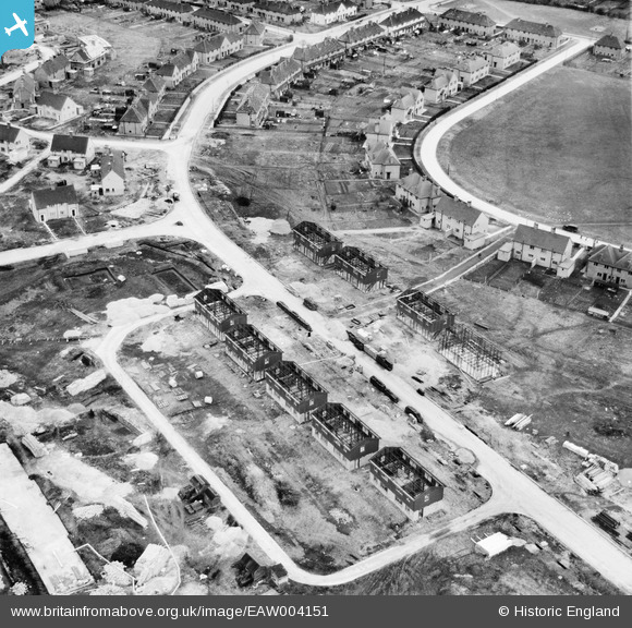
EAW004151 ENGLAND (1947). Prebendal Avenue and environs under construction, Aylesbury, 1947
© Copyright OpenStreetMap contributors and licensed by the OpenStreetMap Foundation. 2024. Cartography is licensed as CC BY-SA.
Nearby Images (18)
EAW004151

EAW004340

EAW004341

EAW003753

EAW003750

EAW004344

EAW003751

EAW004154A

EAW004152

EAW004345

EAW004343

EAW003749

EAW004347

EAW004342

EAW004153

EAW003748

EAW003747

EAW004346

Details
| Title | [EAW004151] Prebendal Avenue and environs under construction, Aylesbury, 1947 |
| Reference | EAW004151 |
| Date | 5-April-1947 |
| Link | |
| Place name | AYLESBURY |
| Parish | AYLESBURY |
| District | |
| Country | ENGLAND |
| Easting / Northing | 481429, 213166 |
| Longitude / Latitude | -0.81870373247798, 51.810742906082 |
| National Grid Reference | SP814132 |
Pins
User Comment Contributions
British Iron and Steel Federation houses under construction. |
 KeithFP |
Monday 26th of August 2013 12:05:54 PM |


