
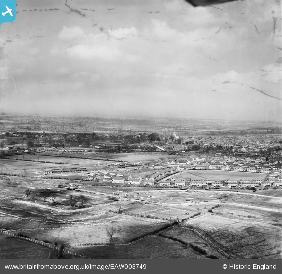
EAW003749 ENGLAND (1947). Construction of housing and roads at the Southcourt Estate, Aylesbury, from the south-west, 1947. This image has been produced from a damaged negative.
© Copyright OpenStreetMap contributors and licensed by the OpenStreetMap Foundation. 2024. Cartography is licensed as CC BY-SA.
Nearby Images (10)
EAW003749

EAW004152

EAW003751

EAW003753

EAW004340

EAW004341

EAW004151

EAW003752

EAW004154A

EAW004344

Details
| Title | [EAW003749] Construction of housing and roads at the Southcourt Estate, Aylesbury, from the south-west, 1947. This image has been produced from a damaged negative. |
| Reference | EAW003749 |
| Date | 18-March-1947 |
| Link | |
| Place name | AYLESBURY |
| Parish | AYLESBURY |
| District | |
| Country | ENGLAND |
| Easting / Northing | 481336, 212984 |
| Longitude / Latitude | -0.8200953118947, 51.809120246426 |
| National Grid Reference | SP813130 |
Pins
Be the first to add a comment to this image!


