
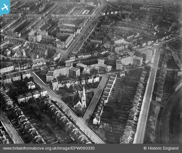
EPW060335 ENGLAND (1939). St Saviour's Church, Eton Rise, Eton Hall, Eton Place and environs, Camden, 1939
© Hawlfraint cyfranwyr OpenStreetMap a thrwyddedwyd gan yr OpenStreetMap Foundation. 2024. Trwyddedir y gartograffeg fel CC BY-SA.
Delweddau cyfagos (30)
EPW060335

EPW060334

EPW058593

EPW060333

EPW056360

EPW056362

EPW060331

EPW058478

EPW060302
, Maitland Park, 1938")
EPW058473

EPW058474

EPW056361

EPW058477

EPW058476

EPW060332

EPW060303
, Maitland Park, 1938")
EPW056358

EPW058475

EPW060304
, Maitland Park, 1938")
EPW056364

EPW060306
, Maitland Park, 1938")
EPW056365

EPW056363

EPW058591

EPW058594

EPW060305
, Maitland Park, 1938")
EPW058592

EPW058590

EPW060330

EPW056359

Manylion
| Pennawd | [EPW060335] St Saviour's Church, Eton Rise, Eton Hall, Eton Place and environs, Camden, 1939 |
| Cyfeirnod | EPW060335 |
| Dyddiad | 11-January-1939 |
| Dolen | |
| Enw lle | CAMDEN |
| Plwyf | |
| Ardal | |
| Gwlad | ENGLAND |
| Dwyreiniad / Gogleddiad | 527963, 184516 |
| Hydred / Lledred | -0.15444297921355, 51.544533929507 |
| Cyfeirnod Grid Cenedlaethol | TQ280845 |
Pinnau
 Class31 |
Tuesday 15th of October 2013 08:59:21 AM | |
Class31 |
Tuesday 15th of October 2013 08:58:34 AM | |
Class31 |
Tuesday 15th of October 2013 08:56:44 AM | |
Class31 |
Tuesday 15th of October 2013 08:55:54 AM | |
Class31 |
Tuesday 15th of October 2013 08:55:07 AM | |
Class31 |
Tuesday 15th of October 2013 08:54:43 AM | |
Class31 |
Tuesday 15th of October 2013 08:54:07 AM |
Cyfraniadau Grŵp
View looking east. |
Class31 |
Tuesday 15th of October 2013 08:57:30 AM |


