
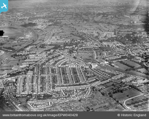
EPW040428 ENGLAND (1932). Housing development around Hendon Central, Hendon, from the south, 1932
© Hawlfraint cyfranwyr OpenStreetMap a thrwyddedwyd gan yr OpenStreetMap Foundation. 2024. Trwyddedir y gartograffeg fel CC BY-SA.
Delweddau cyfagos (7)
EPW040428

EPW031655

EPW040429

EPW040426

EPW040427

EPW040431

EPW040432

Manylion
| Pennawd | [EPW040428] Housing development around Hendon Central, Hendon, from the south, 1932 |
| Cyfeirnod | EPW040428 |
| Dyddiad | September-1932 |
| Dolen | |
| Enw lle | HENDON |
| Plwyf | |
| Ardal | |
| Gwlad | ENGLAND |
| Dwyreiniad / Gogleddiad | 522784, 188181 |
| Hydred / Lledred | -0.22781793324328, 51.578626146477 |
| Cyfeirnod Grid Cenedlaethol | TQ228882 |
Pinnau
 Wordsmith52 |
Saturday 31st of August 2013 05:03:42 PM | |
Now part of the site of Brent Cross Shopping Centre. |
Wordsmith52 |
Saturday 31st of August 2013 05:05:38 PM |
Wordsmith52 |
Saturday 31st of August 2013 05:02:12 PM | |
Wordsmith52 |
Saturday 31st of August 2013 05:01:30 PM | |
Wordsmith52 |
Saturday 31st of August 2013 05:00:53 PM | |
Wordsmith52 |
Saturday 31st of August 2013 05:00:08 PM |