
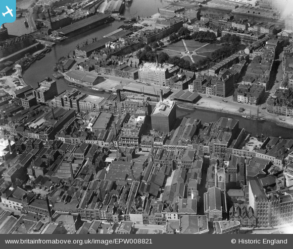
EPW008821 ENGLAND (1923). Redcliffe Wharf and Queen Square, Bristol, 1923
© Hawlfraint cyfranwyr OpenStreetMap a thrwyddedwyd gan yr OpenStreetMap Foundation. 2024. Trwyddedir y gartograffeg fel CC BY-SA.
Delweddau cyfagos (26)
EPW008821

EPW008825

EPW008826

EPW008823

EPW008822

EPW008826A

EPW008819

EPW008820

EAW032261

EAW032260

EPW008824

EAW032255

EAW032258

EAW032254

EAW032257

EAW026795

EAW032256

EAW032259

EAW000738

EPR000085

EPW034455

EAW000739

EPW034452

EPW034458

EPR000072

EPW034457

Manylion
| Pennawd | [EPW008821] Redcliffe Wharf and Queen Square, Bristol, 1923 |
| Cyfeirnod | EPW008821 |
| Dyddiad | 1923 |
| Dolen | |
| Enw lle | BRISTOL |
| Plwyf | |
| Ardal | |
| Gwlad | ENGLAND |
| Dwyreiniad / Gogleddiad | 359041, 172644 |
| Hydred / Lledred | -2.5895035397082, 51.450808035005 |
| Cyfeirnod Grid Cenedlaethol | ST590726 |
Pinnau
 derek2847 |
Monday 5th of February 2018 08:54:18 PM | |
derek2847 |
Monday 5th of February 2018 07:09:34 PM | |
derek2847 |
Monday 5th of February 2018 07:06:39 PM | |
derek2847 |
Monday 5th of February 2018 07:04:45 PM | |
 Class31 |
Monday 24th of June 2013 05:05:11 PM | |
Class31 |
Monday 24th of June 2013 05:04:52 PM |


