
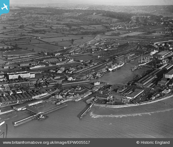
epw005517 ENGLAND (1921). Avonmouth Dock, Avonmouth, from the west, 1921
© Copyright OpenStreetMap contributors and licensed by the OpenStreetMap Foundation. 2024. Cartography is licensed as CC BY-SA.
Nearby Images (14)
EPW005517

EPW043046

EPW043047

EPW043049

EPW008651

EPW043045

EPW046969

EPW043048

EPW005488

EPW027948

EPW043044

EPW027950

EPW005529

EPW005530

Details
| Title | [EPW005517] Avonmouth Dock, Avonmouth, from the west, 1921 |
| Reference | EPW005517 |
| Date | 20-March-1921 |
| Link | |
| Place name | AVONMOUTH |
| Parish | |
| District | |
| Country | ENGLAND |
| Easting / Northing | 350943, 178162 |
| Longitude / Latitude | -2.7068119337621, 51.499781253179 |
| National Grid Reference | ST509782 |
Pins
 Richard Coates |
Friday 24th of February 2023 11:07:36 AM | |
Richard Coates |
Friday 24th of February 2023 11:06:13 AM | |
Geoff |
Thursday 31st of July 2014 02:44:01 PM | |
Geoff |
Thursday 31st of July 2014 02:04:59 PM | |
Geoff |
Thursday 31st of July 2014 01:55:25 PM | |
Geoff |
Thursday 31st of July 2014 01:53:35 PM |