
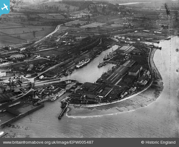
epw005487 ENGLAND (1921). Avonmouth Dock, Avonmouth, 1921
© Copyright OpenStreetMap contributors and licensed by the OpenStreetMap Foundation. 2024. Cartography is licensed as CC BY-SA.
Nearby Images (17)
EPW005487

EAW002071

EPW027951

EPR000058

EPW027954

EPR000059

EPW005488

EPW046970

EPW014691

EPW008649

EPW043043

EPR000061

EPW043044

EPW005513

EPW008651

EAW002253

EPW027946

Details
| Title | [EPW005487] Avonmouth Dock, Avonmouth, 1921 |
| Reference | EPW005487 |
| Date | 20-March-1921 |
| Link | |
| Place name | AVONMOUTH |
| Parish | |
| District | |
| Country | ENGLAND |
| Easting / Northing | 351221, 177990 |
| Longitude / Latitude | -2.7027830544411, 51.498258724343 |
| National Grid Reference | ST512780 |
Pins
 MB |
Saturday 20th of August 2016 03:37:36 PM | |
MB |
Saturday 20th of August 2016 03:36:57 PM | |
NicTomkins |
Sunday 13th of July 2014 05:36:32 PM |