
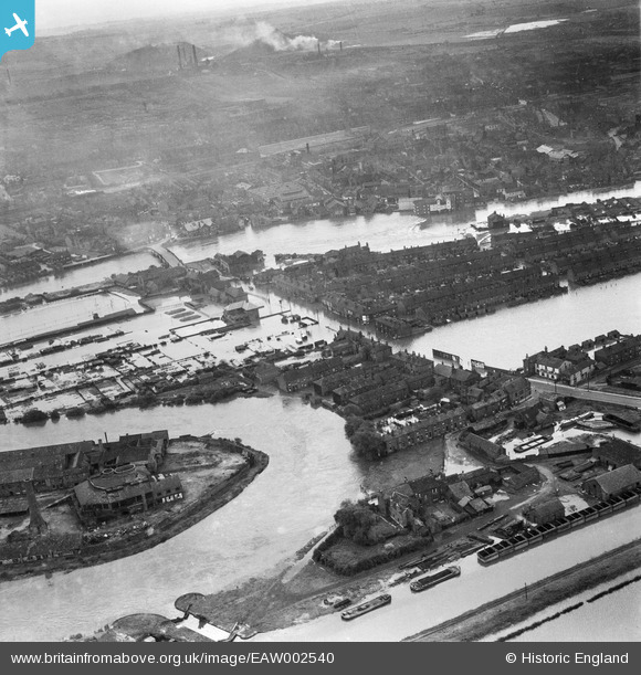
eaw002540 ENGLAND (1946). A large area of flooding around Lock Lane, Castleford, from the north-east, 1946
© Copyright OpenStreetMap contributors and licensed by the OpenStreetMap Foundation. 2025. Cartography is licensed as CC BY-SA.
Nearby Images (6)
EAW002540

EAW002542

EAW002533

EAW002538A

EAW002544

EAW002534

Details
| Title | [EAW002540] A large area of flooding around Lock Lane, Castleford, from the north-east, 1946 |
| Reference | EAW002540 |
| Date | 21-September-1946 |
| Link | |
| Place name | CASTLEFORD |
| Parish | |
| District | |
| Country | ENGLAND |
| Easting / Northing | 442896, 426295 |
| Longitude / Latitude | -1.3497111107909, 53.731061058055 |
| National Grid Reference | SE429263 |
Pins

padraic |
Wednesday 27th of May 2020 06:52:21 PM | |
|
padraic |
Wednesday 27th of May 2020 06:44:59 PM | |
|
dyey |
Thursday 12th of November 2015 08:54:12 PM | |

Cabby |
Tuesday 25th of February 2014 10:06:24 PM | |

Derekdye |
Thursday 21st of November 2013 09:10:25 PM | |
|
Derekdye |
Thursday 21st of November 2013 09:08:57 PM |