Skip to main content
Britain from Above
Cymraeg
|
English
Login
|
Register
Toggle navigation
Home
Legacy
About
Map
Galleries
Groups
Help
Search
All Countries (96344)
England (82521)
Scotland (6398)
Wales (4321)
Rest of World (3104)
Belgium (7)
France (27)
Germany (2)
Guernsey (116)
Iran (8)
Iraq (6)
Ireland (1466)
Isle of Man (75)
Jersey (122)
Netherlands (20)
Northern Ireland (1163)
Spain (9)
Switzerland (26)
Search > Grid
Grid
Map
Page 1
Showing 1 to 7 of 7 as page 1 of 1
Image Reference
Year
Country
low to high
high to low
Sort
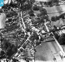
EPW023655
[1928]
Plympton Castle and St Maurice's Church, Plympton, 1928. This image h...
3
EAW026936
[1949]
May Avenue, Maurice Road and the surrounding residential area, Canvey...
EAW045299
[1952]
Housing around May Avenue, Sprundel Avenue and Maurice Road, Canvey I...
3
EAW051047
[1953]
Eastern Esplanade, Maurice Road and environs, Canvey Island, 1953...
EPW010875
[1924]
Housing surrounding the High Street and Maurice Road, Canvey Island, ...
EPW023654
[1928]
St Maurice's Church and environs, Plympton, 1928. This image has been...
EPW023657
[1928]
The castle and St Maurice's Church, Plympton, 1928. This image has be...
Page 1