
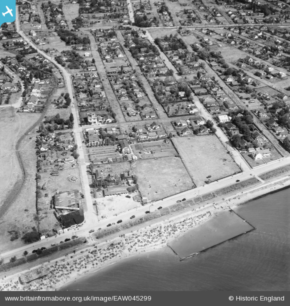
EAW045299 ENGLAND (1952). Housing around May Avenue, Sprundel Avenue and Maurice Road, Canvey Island, 1952
© Copyright OpenStreetMap contributors and licensed by the OpenStreetMap Foundation. 2026. Cartography is licensed as CC BY-SA.
Nearby Images (14)
EAW045299

EAW051048

EAW051011

EAW045328

EAW026918

EAW045300

EAW051010

EAW051047

EAW026919

EAW045329

EAW051049

EAW051057

EAW051012

EAW051050

Details
| Title | [EAW045299] Housing around May Avenue, Sprundel Avenue and Maurice Road, Canvey Island, 1952 |
| Reference | EAW045299 |
| Date | 2-August-1952 |
| Link | |
| Place name | CANVEY ISLAND |
| Parish | CANVEY ISLAND |
| District | |
| Country | ENGLAND |
| Easting / Northing | 580610, 182629 |
| Longitude / Latitude | 0.60317447598311, 51.513191458906 |
| National Grid Reference | TQ806826 |
