
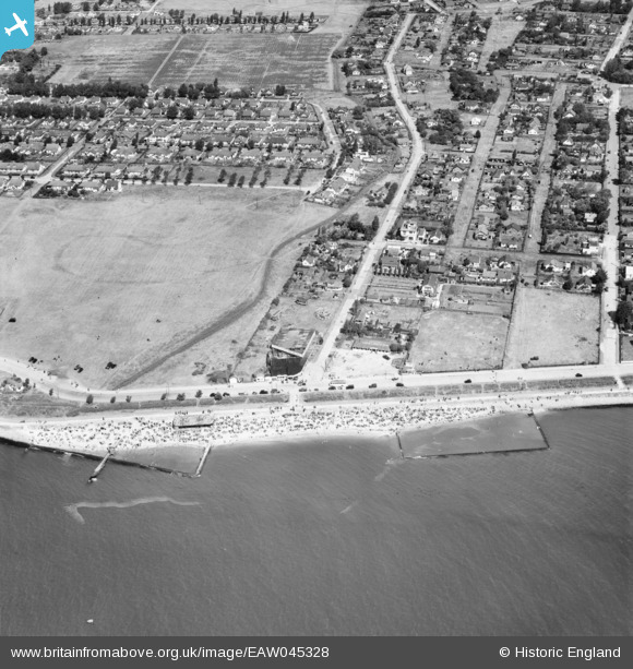
EAW045328 ENGLAND (1952). Housing around May Avenue, Canvey Island, 1952
© Copyright OpenStreetMap contributors and licensed by the OpenStreetMap Foundation. 2026. Cartography is licensed as CC BY-SA.
Nearby Images (17)
EAW045328

EAW051011

EAW045300

EAW045329

EAW045299

EAW051048

EAW051049

EAW051057

EAW026918

EAW051012

EAW051050

EAW051047

EAW051010

EAW045301

EAW045327

EAW026919

EAW051051

Details
| Title | [EAW045328] Housing around May Avenue, Canvey Island, 1952 |
| Reference | EAW045328 |
| Date | 2-August-1952 |
| Link | |
| Place name | CANVEY ISLAND |
| Parish | CANVEY ISLAND |
| District | |
| Country | ENGLAND |
| Easting / Northing | 580527, 182581 |
| Longitude / Latitude | 0.60195492248596, 51.512786793564 |
| National Grid Reference | TQ805826 |
Pins
Be the first to add a comment to this image!