
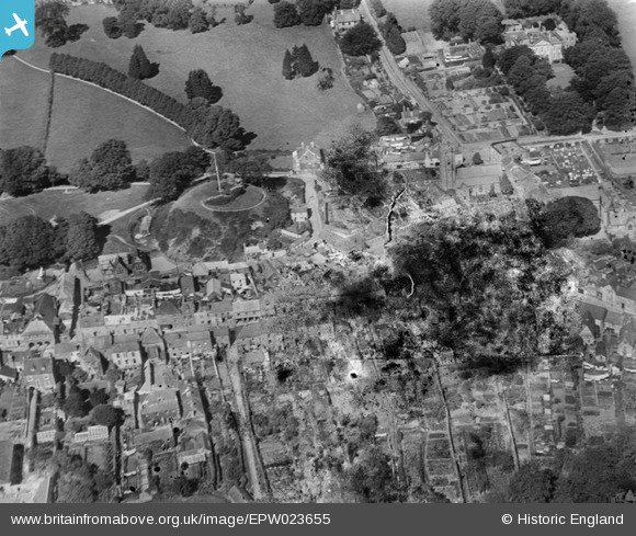
EPW023655 ENGLAND (1928). Plympton Castle and St Maurice's Church, Plympton, 1928. This image has been produced from a damaged negative.
© Copyright OpenStreetMap contributors and licensed by the OpenStreetMap Foundation. 2026. Cartography is licensed as CC BY-SA.
Nearby Images (3)
EPW023655

EPW023657

EPW023654

Details
| Title | [EPW023655] Plympton Castle and St Maurice's Church, Plympton, 1928. This image has been produced from a damaged negative. |
| Reference | EPW023655 |
| Date | September-1928 |
| Link | |
| Place name | PLYMPTON |
| Parish | |
| District | |
| Country | ENGLAND |
| Easting / Northing | 254503, 55714 |
| Longitude / Latitude | -4.0467462946475, 50.382683985262 |
| National Grid Reference | SX545557 |
Pins

MB |
Tuesday 6th of November 2012 04:32:27 PM | |
|
MB |
Tuesday 6th of November 2012 04:23:36 PM | |
Allen T |
Friday 28th of September 2012 02:29:49 PM |