
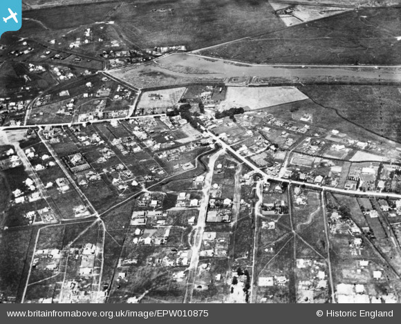
EPW010875 ENGLAND (1924). Housing surrounding the High Street and Maurice Road, Canvey Island, 1924. This image has been produced from a print.
© Copyright OpenStreetMap contributors and licensed by the OpenStreetMap Foundation. 2025. Cartography is licensed as CC BY-SA.
Nearby Images (2)
EPW010875

EAW026936

Details
| Title | [EPW010875] Housing surrounding the High Street and Maurice Road, Canvey Island, 1924. This image has been produced from a print. |
| Reference | EPW010875 |
| Date | July-1924 |
| Link | |
| Place name | CANVEY ISLAND |
| Parish | CANVEY ISLAND |
| District | |
| Country | ENGLAND |
| Easting / Northing | 580706, 183449 |
| Longitude / Latitude | 0.60497706413494, 51.520526968288 |
| National Grid Reference | TQ807834 |
Pins
Be the first to add a comment to this image!