Skip to main content
Britain from Above
Cymraeg
|
English
Login
|
Register
Toggle navigation
Home
Legacy
About
Map
Galleries
Groups
Help
Search
All Countries (96344)
England (82521)
Scotland (6398)
Wales (4321)
Rest of World (3104)
Belgium (7)
France (27)
Germany (2)
Guernsey (116)
Iran (8)
Iraq (6)
Ireland (1466)
Isle of Man (75)
Jersey (122)
Netherlands (20)
Northern Ireland (1163)
Spain (9)
Switzerland (26)
Search > Grid
Grid
Map
Page 1
Showing 1 to 11 of 11 as page 1 of 1
Image Reference
Year
Country
low to high
high to low
Sort
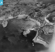
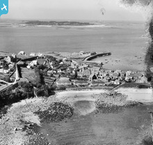
EPW059632
[1938]
Woolpack Point, The Garrison and Hugh Town, St Mary's, from the south...
0
EPW059643
[1938]
[EPW059643] St Mary's Pool, Rat Island and Hugh Town, St Mary's, 1938
0
EPW059645
[1938]
[EPW059645] Hugh Town, St Mary's, from the south-east, 1938
0
EPW059651
[1938]
[EPW059651] Hugh Town, St Mary's, 1938
0
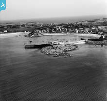
EPW059653
[1938]
Rat Island, the Town Beach and Hugh Town, St Mary's, from the north-w...
0
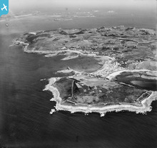
EPW059655
[1938]
The Garrison, St Mary's Pool and Hugh Town, St Mary's, 1938...
0
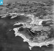
EPW059656
[1938]
The Garrison, St Mary's Pool and Hugh Town, St Mary's, 1938...
0
EPW059847
[1938]
[EPW059847] Hugh Town, St Mary's, from the south-east, 1938
0
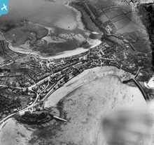
EPW059850
[1938]
[EPW059850] Hugh Town, St Mary's, 1938
6
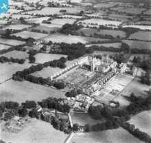
EAW011029
[1947]
[EAW011029] St Hugh's Monastery and Parkminster Farm, Cowfold, 1947
0
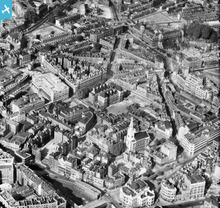
EAW011212
[1947]
St James's Church, the Hugh Myddleton Secondary School and environs, ...
43
Page 1