
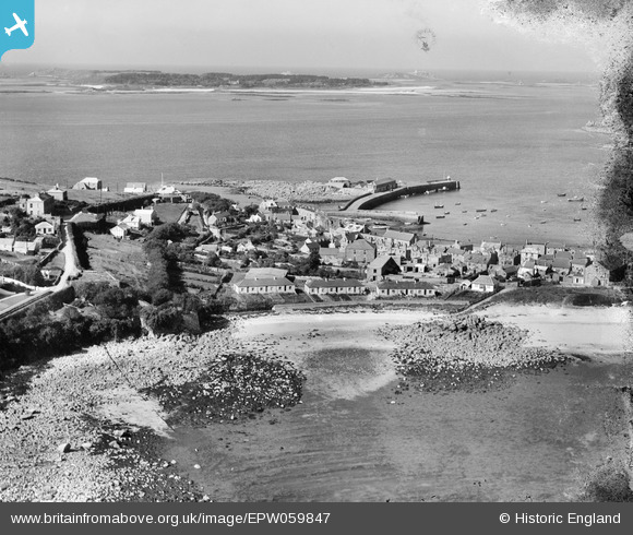
EPW059847 ENGLAND (1938). Hugh Town, St Mary's, from the south-east, 1938
© Copyright OpenStreetMap contributors and licensed by the OpenStreetMap Foundation. 2025. Cartography is licensed as CC BY-SA.
Nearby Images (4)
EPW059847

EPW059645

EPW059850

EPW059656

Details
| Title | [EPW059847] Hugh Town, St Mary's, from the south-east, 1938 |
| Reference | EPW059847 |
| Date | 22-September-1938 |
| Link | |
| Place name | ST MARY'S |
| Parish | ST. MARY'S |
| District | |
| Country | ENGLAND |
| Easting / Northing | 90209, 10417 |
| Longitude / Latitude | -6.3159587034362, 49.912903159765 |
| National Grid Reference | SV902104 |
Pins
Be the first to add a comment to this image!