
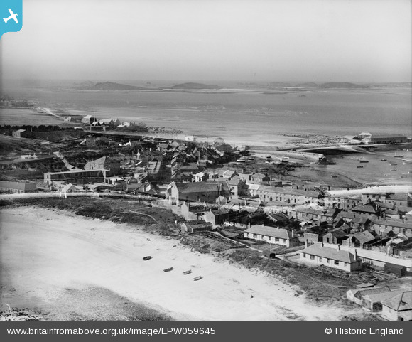
EPW059645 ENGLAND (1938). Hugh Town, St Mary's, from the south-east, 1938
© Copyright OpenStreetMap contributors and licensed by the OpenStreetMap Foundation. 2025. Cartography is licensed as CC BY-SA.
Nearby Images (5)
EPW059645

EPW059850

EPW059647

EPW059847

EPW059651

Details
| Title | [EPW059645] Hugh Town, St Mary's, from the south-east, 1938 |
| Reference | EPW059645 |
| Date | 15-September-1938 |
| Link | |
| Place name | ST MARY'S |
| Parish | ST. MARY'S |
| District | |
| Country | ENGLAND |
| Easting / Northing | 90370, 10457 |
| Longitude / Latitude | -6.3137544649504, 49.913345297677 |
| National Grid Reference | SV904105 |
Pins

MML |
Monday 18th of August 2025 10:36:24 AM |