
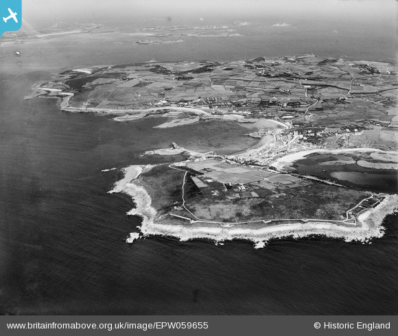
EPW059655 ENGLAND (1938). The Garrison, St Mary's Pool and Hugh Town, St Mary's, 1938
© Copyright OpenStreetMap contributors and licensed by the OpenStreetMap Foundation. 2025. Cartography is licensed as CC BY-SA.
Nearby Images (5)
EPW059655

EPW059656

EPW059654

EPW059628

EPW059643

Details
| Title | [EPW059655] The Garrison, St Mary's Pool and Hugh Town, St Mary's, 1938 |
| Reference | EPW059655 |
| Date | 15-September-1938 |
| Link | |
| Place name | ST MARY'S |
| Parish | ST. MARY'S |
| District | |
| Country | ENGLAND |
| Easting / Northing | 90061, 10718 |
| Longitude / Latitude | -6.3182559652574, 49.915526280684 |
| National Grid Reference | SV901107 |
Pins
Be the first to add a comment to this image!