
Scheduled Maintenance
This website will undergo scheduled maintenance on Tuesday, September 10th, between 11:00 and 15:00, as well as on Thursday, September 12th, between 10:00 and 12:00. During this time, services may be temporarily disrupted. We apologise for any inconvenience.
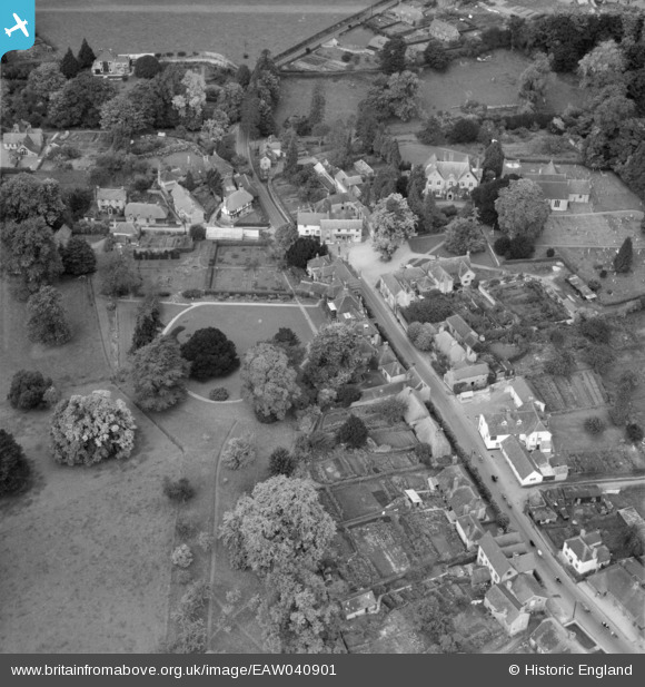
eaw040901 ENGLAND (1951). The village by The Plestor and The Wakes, Selborne, 1951
© Copyright OpenStreetMap contributors and licensed by the OpenStreetMap Foundation. 2024. Cartography is licensed as CC BY-SA.
Nearby Images (7)
EAW040901

EAW014374

EAW033435

EAW014373

EAW014372

EAW033434

EAW033433

Details
| Title | [EAW040901] The village by The Plestor and The Wakes, Selborne, 1951 |
| Reference | EAW040901 |
| Date | 19-October-1951 |
| Link | |
| Place name | SELBORNE |
| Parish | SELBORNE |
| District | |
| Country | ENGLAND |
| Easting / Northing | 474077, 133668 |
| Longitude / Latitude | -0.94199351822342, 51.096997785452 |
| National Grid Reference | SU741337 |
Pins
 flubber |
Wednesday 23rd of April 2014 12:07:15 PM |