
Scheduled Maintenance
This website will undergo scheduled maintenance on Tuesday, September 10th, between 11:00 and 15:00, as well as on Thursday, September 12th, between 10:00 and 12:00. During this time, services may be temporarily disrupted. We apologise for any inconvenience.
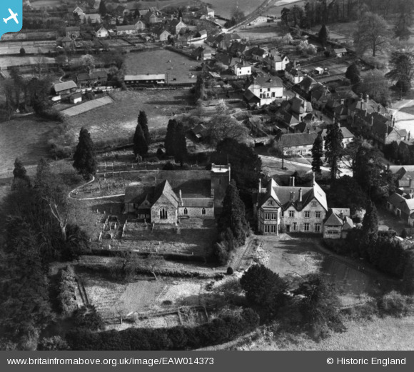
EAW014373 ENGLAND (1948). St Mary's Church and The Vicarage, Selborne, 1948. This image has been produced from a print.
© Copyright OpenStreetMap contributors and licensed by the OpenStreetMap Foundation. 2024. Cartography is licensed as CC BY-SA.
Nearby Images (7)
EAW014373

EAW014372

EAW014374

EAW040901

EAW033435

EAW033434

EAW033433

Details
| Title | [EAW014373] St Mary's Church and The Vicarage, Selborne, 1948. This image has been produced from a print. |
| Reference | EAW014373 |
| Date | 13-April-1948 |
| Link | |
| Place name | SELBORNE |
| Parish | SELBORNE |
| District | |
| Country | ENGLAND |
| Easting / Northing | 474114, 133759 |
| Longitude / Latitude | -0.94144647587443, 51.097811237621 |
| National Grid Reference | SU741338 |
Pins
Be the first to add a comment to this image!