
Scheduled Maintenance
This website will undergo scheduled maintenance on Tuesday, September 10th, between 11:00 and 15:00, as well as on Thursday, September 12th, between 10:00 and 12:00. During this time, services may be temporarily disrupted. We apologise for any inconvenience.
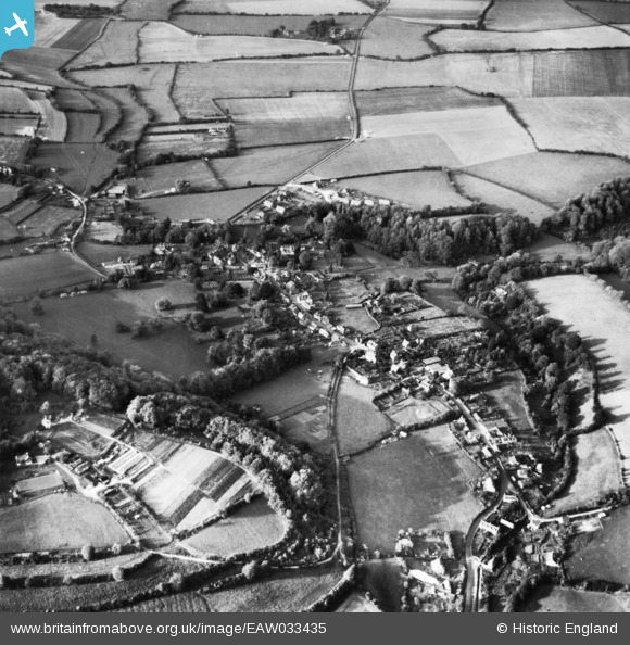
EAW033435 ENGLAND (1950). The village, Selborne, 1950. This image has been produced from a print.
© Copyright OpenStreetMap contributors and licensed by the OpenStreetMap Foundation. 2024. Cartography is licensed as CC BY-SA.
Nearby Images (7)
EAW033435

EAW040901

EAW014372

EAW014374

EAW033433

EAW014373

EAW033434

Details
| Title | [EAW033435] The village, Selborne, 1950. This image has been produced from a print. |
| Reference | EAW033435 |
| Date | 11-October-1950 |
| Link | |
| Place name | SELBORNE |
| Parish | SELBORNE |
| District | |
| Country | ENGLAND |
| Easting / Northing | 474158, 133635 |
| Longitude / Latitude | -0.94084362532297, 51.096690590004 |
| National Grid Reference | SU742336 |
Pins
Be the first to add a comment to this image!