
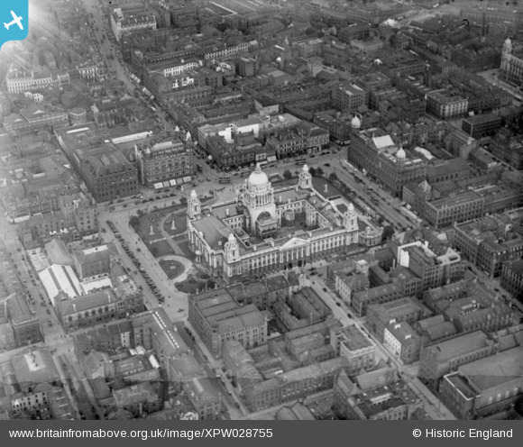
XPW028755 NORTHERN IRELAND (1929). General View, Belfast, Belfast, Northern Ireland, 1929. Oblique aerial photograph taken facing North.
© Copyright OpenStreetMap contributors and licensed by the OpenStreetMap Foundation. 2026. Cartography is licensed as CC BY-SA.
Nearby Images (15)
XPW028755

XAW033116

XPW015311

XPW028756

XAW027628

XPW042478

XAW033114

XAW033113

XPW015520

XPW015325

XAW009546

XAW033115

XPW042479

XPW008414

XAW027625

Details
| Title | [XPW028755] General View, Belfast, Belfast, Northern Ireland, 1929. Oblique aerial photograph taken facing North. |
| Reference | XPW028755 |
| Date | 1929 |
| Link | |
| Place name | BELFAST |
| Parish | NORTHERN IRELAND |
| District | |
| Country | NORTHERN IRELAND |
| Easting / Northing | 146266, 529536 |
| Longitude / Latitude | -5.929681, 54.597113 |
| National Grid Reference |
Pins

richmondboy |
Sunday 5th of August 2018 04:51:15 PM |
User Comment Contributions
Ooops! Sorry Patrick, I hadn't seen your comment before I posted mine. |
touchwood |
Monday 27th of October 2014 01:35:05 PM |
I think this photograph is the wrong way round. It's a mirror image of how it should be. |
touchwood |
Monday 27th of October 2014 01:34:33 PM |
I believe this image needs to be flipped horizontally! |
Patrick Davey |
Saturday 18th of October 2014 02:33:42 PM |