
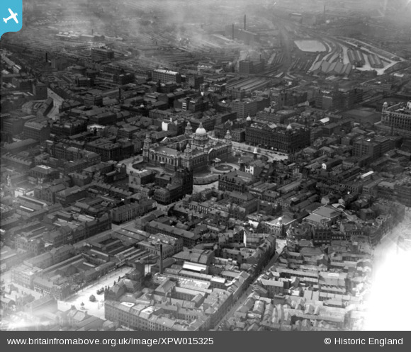
XPW015325 NORTHERN IRELAND (1926). Belfast City Hall, Belfast, Belfast, Northern Ireland, 1926. Oblique aerial photograph taken facing South/West.
© Copyright OpenStreetMap contributors and licensed by the OpenStreetMap Foundation. 2026. Cartography is licensed as CC BY-SA.
Nearby Images (14)
XPW015325

XAW033113

XAW033115

XPW008414

XPW015520

XAW033114

XAW027625

XPW042478

XPW028756

XAW009546

XPW028755

XPW015311

XAW033116

XAW027628

Details
| Title | [XPW015325] Belfast City Hall, Belfast, Belfast, Northern Ireland, 1926. Oblique aerial photograph taken facing South/West. |
| Reference | XPW015325 |
| Date | 1926 |
| Link | |
| Place name | BELFAST |
| Parish | NORTHERN IRELAND |
| District | |
| Country | NORTHERN IRELAND |
| Easting / Northing | 146154, 529419 |
| Longitude / Latitude | -5.93132, 54.596006 |
| National Grid Reference |

