
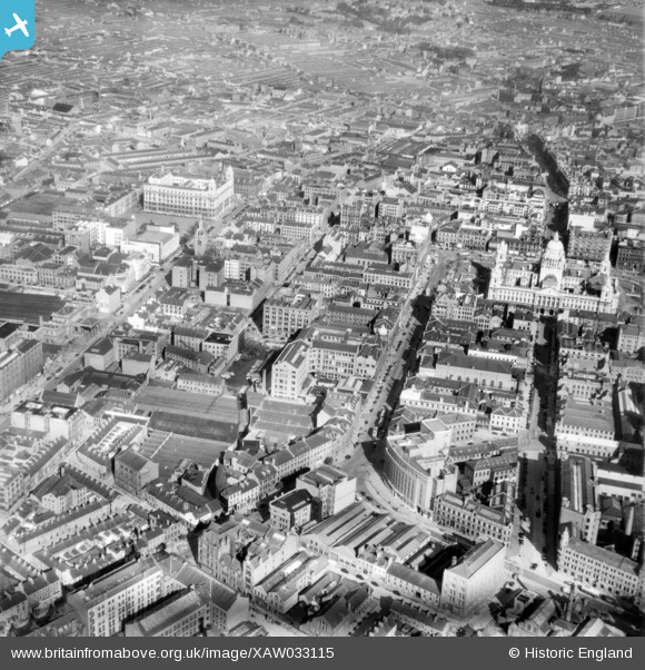
XAW033115 NORTHERN IRELAND (1950). General View, Belfast, Belfast, Northern Ireland, 1950. Oblique aerial photograph taken facing North/West.
© Copyright OpenStreetMap contributors and licensed by the OpenStreetMap Foundation. 2026. Cartography is licensed as CC BY-SA.
Nearby Images (14)
XAW033115

XPW008414

XPW015325

XAW027625

XAW033113

XPW015520

XAW033114

XPW042478

XAW009546

XPW028756

XPW028755

XPW015311

XAW033116

XAW027628

Details
| Title | [XAW033115] General View, Belfast, Belfast, Northern Ireland, 1950. Oblique aerial photograph taken facing North/West. |
| Reference | XAW033115 |
| Date | 15-September-1950 |
| Link | |
| Place name | BELFAST |
| Parish | NORTHERN IRELAND |
| District | |
| Country | NORTHERN IRELAND |
| Easting / Northing | 146117, 529383 |
| Longitude / Latitude | -5.931854, 54.595663 |
| National Grid Reference |
Pins

poe |
Thursday 1st of January 2026 12:17:23 AM | |
|
poe |
Sunday 8th of March 2020 08:34:54 PM | |
|
Stephen Craig |
Sunday 5th of April 2015 02:13:55 PM |