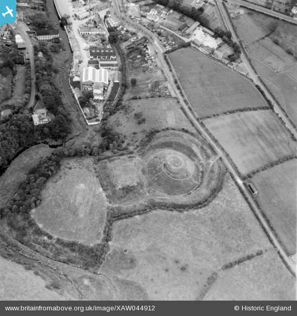
XAW044912 NORTHERN IRELAND (1952). Earth Mound, Dromore, Banbridge, Northern Ireland, 1952. Oblique aerial photograph taken facing North/West.
© Copyright OpenStreetMap contributors and licensed by the OpenStreetMap Foundation. 2026. Cartography is licensed as CC BY-SA.
Nearby Images (6)
Details
| Title | [XAW044912] Earth Mound, Dromore, Banbridge, Northern Ireland, 1952. Oblique aerial photograph taken facing North/West. |
| Reference | XAW044912 |
| Date | 1952 |
| Link | |
| Place name | DROMORE |
| Parish | NORTHERN IRELAND |
| District | |
| Country | NORTHERN IRELAND |
| Easting / Northing | 131254, 509802 |
| Longitude / Latitude | -6.143464, 54.412469 |
| National Grid Reference |
Pins

Coolian |
Thursday 30th of October 2014 04:45:32 PM |


![[XAW044912] Earth Mound, Dromore, Banbridge, Northern Ireland, 1952. Oblique aerial photograph taken facing North/West.](http://britainfromabove.org.uk/sites/all/libraries/aerofilms-images/public/100x100/XAW/044/XAW044912.jpg)
![[XAW044911] Earth Mound, Dromore, Banbridge, Northern Ireland, 1952. Oblique aerial photograph taken facing North.](http://britainfromabove.org.uk/sites/all/libraries/aerofilms-images/public/100x100/XAW/044/XAW044911.jpg)
![[XAW013345] General View, Belfast, Banbridge, Northern Ireland, 1948. Oblique aerial photograph taken facing North/East.](http://britainfromabove.org.uk/sites/all/libraries/aerofilms-images/public/100x100/XAW/013/XAW013345.jpg)
![[XAW040579] Mound, Dromore, Banbridge, Northern Ireland, 1951. Oblique aerial photograph taken facing South.](http://britainfromabove.org.uk/sites/all/libraries/aerofilms-images/public/100x100/XAW/040/XAW040579.jpg)
![[XAW051884] Earth Works, Dromore spec, Dromore, Banbridge, Northern Ireland, 1953. Oblique aerial photograph taken facing North/West.](http://britainfromabove.org.uk/sites/all/libraries/aerofilms-images/public/100x100/XAW/051/XAW051884.jpg)
![[XAW013344] Castle Sites, Dromore, Banbridge, Northern Ireland, 1948. Oblique aerial photograph taken facing North/West.](http://britainfromabove.org.uk/sites/all/libraries/aerofilms-images/public/100x100/XAW/013/XAW013344.jpg)