
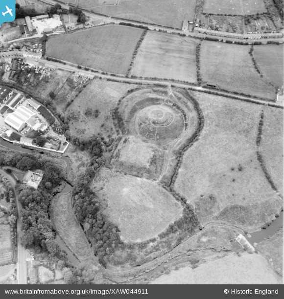
XAW044911 NORTHERN IRELAND (1952). Earth Mound, Dromore, Banbridge, Northern Ireland, 1952. Oblique aerial photograph taken facing North.
© Copyright OpenStreetMap contributors and licensed by the OpenStreetMap Foundation. 2026. Cartography is licensed as CC BY-SA.
Nearby Images (6)
XAW044911

XAW044912

XAW013345

XAW040579

XAW051884

XAW013344

Details
| Title | [XAW044911] Earth Mound, Dromore, Banbridge, Northern Ireland, 1952. Oblique aerial photograph taken facing North. |
| Reference | XAW044911 |
| Date | 1952 |
| Link | |
| Place name | DROMORE |
| Parish | NORTHERN IRELAND |
| District | |
| Country | NORTHERN IRELAND |
| Easting / Northing | 131254, 509801 |
| Longitude / Latitude | -6.143472, 54.412462 |
| National Grid Reference |
Pins
Be the first to add a comment to this image!