
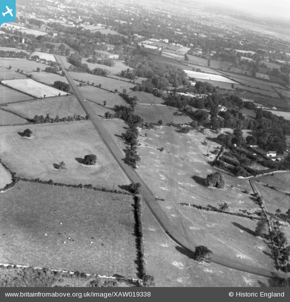
XAW019338 IRELAND (1948). Clonard House, Dundrum, Dublin, Ireland, 1948. Oblique aerial photograph taken facing South/East.
© Copyright OpenStreetMap contributors and licensed by the OpenStreetMap Foundation. 2026. Cartography is licensed as CC BY-SA.
Nearby Images (4)
XAW019338

XAW019343

XAW019337

XAW019339

Details
| Title | [XAW019338] Clonard House, Dundrum, Dublin, Ireland, 1948. Oblique aerial photograph taken facing South/East. |
| Reference | XAW019338 |
| Date | 21-September-1948 |
| Link | |
| Place name | DUNDRUM |
| Parish | IRELAND |
| District | |
| Country | IRELAND |
| Easting / Northing | 118264, 383735 |
| Longitude / Latitude | -6.227456, 53.275538 |
| National Grid Reference |
Pins

Windsor70 |
Monday 10th of November 2014 01:40:33 PM | |
I think it is for horse training and jumping. From the Irish Times archives there is mention of a Mr Myerscough training horses at his residence in Clonard, near Dundrum in County Dublin in 1940. Some mention of horse shows, and there seem to be some fences and tracks, although not clear. |
Jms |
Tuesday 17th of April 2018 10:02:46 PM |