
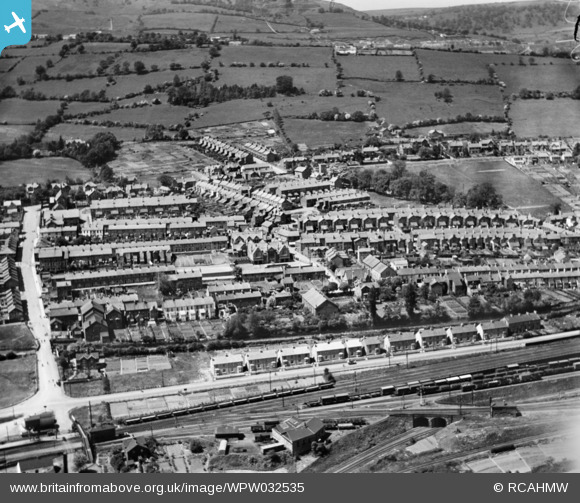
WPW032535 WALES (1930). General view of Griffithstown, oblique aerial view. 5"x4" black and white glass plate negative.
© Copyright OpenStreetMap contributors and licensed by the OpenStreetMap Foundation. 2026. Cartography is licensed as CC BY-SA.
Nearby Images (2)
WPW032534

WPW032535

Details
| Title | [WPW032535] General view of Griffithstown, oblique aerial view. 5"x4" black and white glass plate negative. |
| Reference | WPW032535 |
| Date | June-1930 |
| Link | Coflein Archive Item 6370813 |
| Place name | |
| Parish | |
| District | |
| Country | WALES |
| Easting / Northing | 329370, 198970 |
| Longitude / Latitude | -3.0217794832574, 51.68458023218 |
| National Grid Reference | ST294990 |
Pins

Allan |
Monday 30th of July 2012 05:48:40 PM | |
|
Allan |
Monday 30th of July 2012 05:48:14 PM | |
|
Bloodthorn |
Wednesday 27th of June 2012 12:30:59 PM | |
|
Bloodthorn |
Wednesday 27th of June 2012 12:30:42 PM | |
|
Bloodthorn |
Wednesday 27th of June 2012 12:30:16 PM | |
|
dawlbach |
Tuesday 26th of June 2012 12:25:18 PM |
User Comment Contributions

Griffithstown near Pontypool. |

barney rubble |
Tuesday 7th of August 2012 09:20:41 PM |